Introduction :
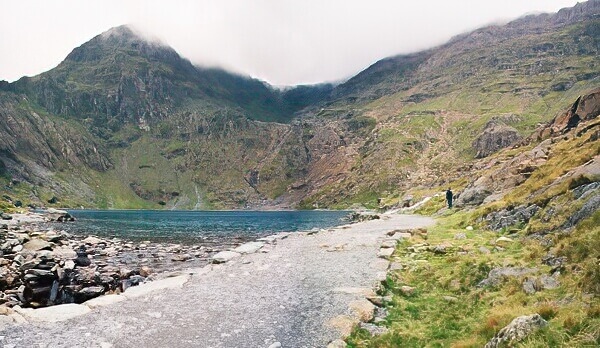
Snowdon and Glaslyn from the Miner's Track.
The massif derives its English name from the Saxon Snow Dun, the snow hill or fortress. Located in the Snowdon National Park, it is the highest of the fifteen 3000 footers in Wales, and the highest mountain in both England and Wales, hence its popularity with the general public. In the Welsh language, the Park is called Parc Genedlaethol Eryri, the word 'Eryri' meaning home of eagles.
The highest point on Snowdon is Yr Wyddfa meaning tumulus. The tumulus in question is said to be that of the giant Rhita Gawr killed by the legendary King Arthur. The mountain's connections with King Arthur do not stop there; into one of its lakes, Llyn Llydaw, a mortally wounded Arthur threw his sword, the mighty Excalibur (Caledfwlch in Welsh).
Whilst this mythology will never be verified, there are other scars left behind by man's exploitation of the mountain. Many of the track ways are those of the now disused iron mines. The ruins of the miner's homes are still very much evident, as are the mines themselves. One should not explorer these dark conduits into the mountains as vertical shafts and rock fall make them extremely hazardous.
Although Snowdon has likely been climbed since time immemorial, the first recorded ascent was by the botanist Thomas Johnson in 1639. During the Victorian period tourists came for the first time to the mountain. Their numbers increasing such, that in 1896, local guides and their ponies were replaced by a steam railway following the more forgiving gradient up from Llanberis. To this day, the Snowdon Mountain Railway carries passenger along the five miles of narrow gauge rack-and-pinion track to the controversial summit cafe and back.
Parking at Pen-y-Pass!
In all but the winter months, you can no longer park at Pen-y-Pass without pre-booking. Instead, you will be instructed to use the car park in Nant Peris (£5 a day as of 2022), and pay for the park and ride bus back to Pen-y-Pass. When parking at Nant Peris and arriving from the Capel Curig direction, drop off any passengers at Pen-y-Pass on route. This will save space on the bus and lessen the impact on your pocket. With Snowdon in the bag, bus or hitch back down to your car at Nant Peris.
Please do not park on the narrow Llanberis Pass road or anywhere else where your car will cause and obstruction.
Routes :
There are many routes to the summit of Snowdon, and I list here only those walking routes in order of ease. The latter have elements of scrambles where hands will be needed. Those looking for more advanced scrambling or climbing routes should seek specialist guides.
Refreshments and souvenirs of your ascent may be purchased at the Snowdon Mountain Railway cafe between mid May and the end of October. However don't rely on the cafe being open for your source of food and drink, it can sometimes be unexpectedly closed.
Llanberis Path
(6.5 km / 4 miles, height gain ~845 m)
The path begins at a cattle grid at the end of the first side road above the Snowdon Mountain Railway Station just outside Llanberis. The junction of this side road and the main A4086 is clearly marked with a signpost 'Footpath up Snowdon'. The path follows a similar course of the Snowdon Mountain Railway. Although this is one of the longer routes to the summit, the slope is mostly comparatively shallow, and thus it is one of the easiest. It is also the path followed during the annual Snowdon Race (Welsh: R's Yr Wyddfa). The first part of the path also leads to the well-known climbing cliff Clogwyn Du'r Arddu.
Rhyd Ddu Path
(5.5 km / 3.5 miles, height gain ~900 m)
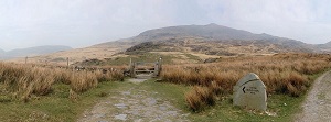 This comparatively quiet path leads from the village of Rhyd Ddu (SH 571526) eastwards, first to a crossing of paths, then north-eastward gently up to Llechog, a ridge overlooking Cwm Clogwyn and its three small lakes. The crest of ridge is then followed eastward then north east along a narrowing arete to the summit of Snowdon itself.
A quieter and longer deviation of the route is to continue eastward from the first crossing of paths, to Bwlch Cwm Llan (a col between Yr Aran and Snowdon). From the col head directly north up a rocky ridge to Allt Maenderyn, along the top of the Clogwyn Du cliff face to meet the Rhyd Ddu path going to the summit.
Snowdon Ranger Path
(5.5 km / 3.5 miles, height gain ~935 m)
The Snowdon Ranger Path is named after the Snowdon Ranger youth hostel on the shores of Llyn Cwellyn (SH 564551), where it begins. It rises gently to Bwlch Cwm Brwynog, a col between Moel Cynghorion and Snowdon, and then along the top of the Clogwyn Du'r Arddu cliff face to Bwlch Glas, a shallow col between Snowdon and Garnedd Ugain. From here the path is the same as the Llanberis Path and runs parallel to the rack-and-pinion railway for the last 700 metres to the summit.
Pyg Track
(5 km / 3 miles, height gain ~725 m)
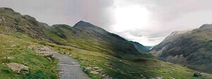 The Pyg Track is a popular path leading from the car park at Pen-y-Pass (SH 647557) via Bwlch y Moch, pass of the pigs in Welsh, from which the route's name is derived. It climbs a well made path, with some steep rocky sections, to Bwlch y Moch, then contours along the lower slopes of Crib Goch before zigzagging above the smaller lake Glaslyn to the col between Snowdon and Garnedd Ugain and on to the summit of Snowdon along the Llanberis Path.
Care should be taken in poor visibility, particularly on ascending the zigzags, and likewise on the descent, ensuring that the correct path is taken down from the col between Snowdon and Garnedd Ugain. Descending too early brings you onto very steep and broken ground above Glaslyn.
Miners' Track
(6.5 km / 4 miles, height gain ~725 m)
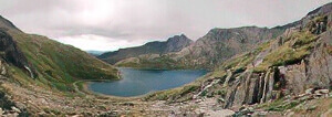 Initially built to service the Britannia Copper Mines above Llyn Glaslyn during the last century, the track continues to serve after the mine was abandoned in 1917.
The Miners' Track begins at the southern end of the Pen-y-Pass car park (SH 647557), passes above Llyn Teyrn with its ruined miners' homes, and then continues for another kilometre before reaching the shore of Llyn Llydaw. Here a short causeway carries the track across the lake where it hugs the northern shore. On reaching a ruined mine building, the path rises for the first time to Glaslyn, blue lake. A brief stroll along lake, and the path zigzags steeply upwards, joins the pyg track, and continues to the col between Snowdon and Garnedd Ugain and on to the summit of Snowdon along the Llanberis Path.
Watkin Path
(5.5 km / 3.5 miles, height gain ~1025 m)
The path is named after Sir Edward Watkin, the Victorian railway tycoon, entrepreneur, dreamer and Liberal M.P.,
The route starts at the Nantgwynant car park (SH 628506) south of Snowdon, at a mere 60 m above sea level, and thus, of all the paths to the summit of Snowdon, this route has the greatest increase in altitude. It follows the course of the Afon Cwm Llan river northwards past waterfalls and the Gladstone Rock, before heading up the hillside to Cwm Ciliau (between Y Lliwedd and Snowdon) then north-west to the Snowdon summit.
Crib Goch route
(5 km / 3 miles, height gain ~865 m)

Crib Goch.
This route requires some experience of scrambling and a head for heights. This is definitely not the route for young children. It is better tackled as an ascent route, a descent by this route would involve down climbing.
Getting there and away :
I have always travelled to Snowdonia by road in a private car, it being about four and half hour from my home town in the South East of England. There is a train station at Betws-y-Coed, a small town often regarded as the gateway to the Snowdonia National Park. There are local bus service that run throughout the park. Check out the bus timetables, including the Snowdon Sherpa Network, at the Gwynedd council website.
Accommodation :
Camping - There are many campsites in the vicinity of Snowdon which can be of more use to those travelling with their own vehicle, though be careful where you park as these sites often get very muddy. Facilities range from the very basic to heated toilet blocks, showers, washing up rooms, etc. Those wishing to eat out can usually find a nearby pub serving hot food. The nearest and most convenient for an ascent of Snowdon from the North, East, or South is at Nant Peris. Check out www.campsites.co.uk.
Youth Hostels - These are open to all ages, and offer good value for money to Youth Hostel Association members. You can usually purchase membership at a hostel if you are not already a member. The Snowdon Ranger hostel makes an excellent base for those ascending from the north west. Whilst the Pen-y-Pass hostel is superbly situated for those attempting the Snowdon Horseshoe. Of course you could even make a traverse of the mountain by walking between the two. For further information, visit www.yha.org.uk.
Bed & Breakfast, Guest Houses and Hotels - These are plentiful, try the following website; www.wales-tourist-information.co.uk.
Maps and Books :
| OpenStreetMaps shows the ascent routes. |
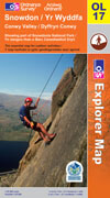
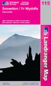 Ordnance Survey produce both a 1:50,000 Landranger and a 1:25,000 Explorer OL map of the region:
The 1:50,000 is number 155 "Snowdon and Caernarfon"
The 1:25,000 is number 17 "Snowdon and Conwy Valley"
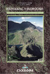
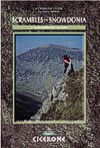 Steve Ashton has written "Hill Walking in Snowdonia" (ISBN 1-85284349-7) and "Scrambles in Snowdonia" (ISBN 1-85284088-9) both published by Cicerone Press. Both are pocket size and ideally suited to be carried on the walk. There is enough in both guides to give weeks of entertainment. Visit www.cicerone.co.uk for further information.
Welsh Lexicon :
A translation of the following Welsh words will make you map interpretation a whole lot easier.
Aber = Mouth of river
Afon = River
Bala = Lake
Bwlch = Pass
Clogwyn = Cliff, Crag, Precipice
Craig = Rocks, Crag
Crib = crest, ridge, brow, ledge (Crib Goch = Red Ridge, from the colour of the rocks)
Cwm = Valley (particularly a glaciated hanging valley), dell
Gribin = Rake (as an implement) describing a ramp like feature.
Llyn = Lake, tarn, pool
Moel = Hill
Nant = Brook, ravine, gorge
Pant = Hollow, valley, dell
Pen = Top of
Useful Links :
Well worth a visit is the website of the Snowdonia National Park. As well as information about the national park, walk suggestions, etc, it host accommodation listings.
For a weather forecast, check www.mountain-forecast.com.