ESC -
Portugal - Torre
, 1993m - InfoIntroduction :
Portugal's official highest point is Ponta do Pico (2351m) on the Azores, an island way out in the Atlantic Ocean. Is this within Europe? Torre "Tower" (1993m) on the other hand is in the Serra da Estrela a range of granite mountain in central Portugal, and is the highest point on the mainland.
|
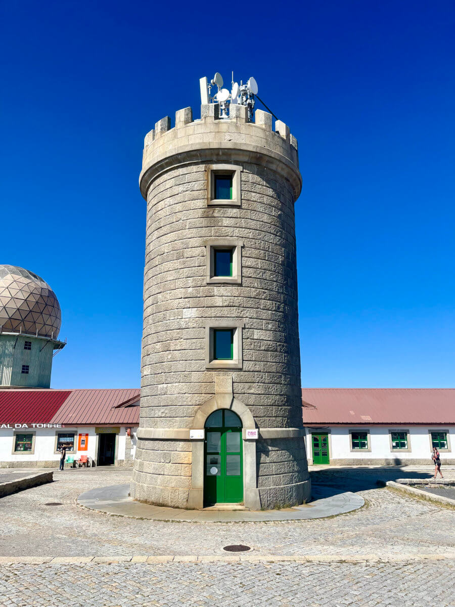
| King João VI's tower after which Torre is name. |
It will not look much like a protected landscape when you arrive at the summit to see the "Tower" (built on the orders of King João VI (1816-1826) to complete the 2000m), car parks, restaurants, shops, chapel, and Portuguese air force radar installation. Facilities for skiers have also added to the slopes. But step away and you'll be in an ancient landscape in which shepherds remain guard their flocks of goats, and paths will often be difficult to find. The weather worn granite rocks and arid vegetation feels unique is unrepeated on any other European Highpoint.
The western section consists of a high plateau, and it is here that the unpredictable weather of the Serra da Estrela can prove ones undoing. Expect hill fog at all times of the year, and with it navigational difficulties.
Routes :
It is possible to drive to the summit on roads from the villages of Sabugueiro, Manteigas, and Covilhã, but this would not be much of a challenge. Instead the summit can be reached via a network of waymarked trails.
Older maps show trails numbered with a T prefix, however these numbers no longer bare any relaction to the system used on the ground and alternative scheme of numbers and route names have been developed. Grande Rota (GR) (Grand Routes) are marked with a horizontal white blaze above a simlar red blaze
The newer routes can be viewed WaymarkedTrails.org.
Please wait for Google Map to load here.
PR6 MTG, the Rota do Glaciar, shares the lower half of it's route with the GR33, Grande Rota do Zêzere (a long distance trail which runs for 370 km along the Zêzere River from its source, in the Serra da Estrela, to where it meets the River Tagus).
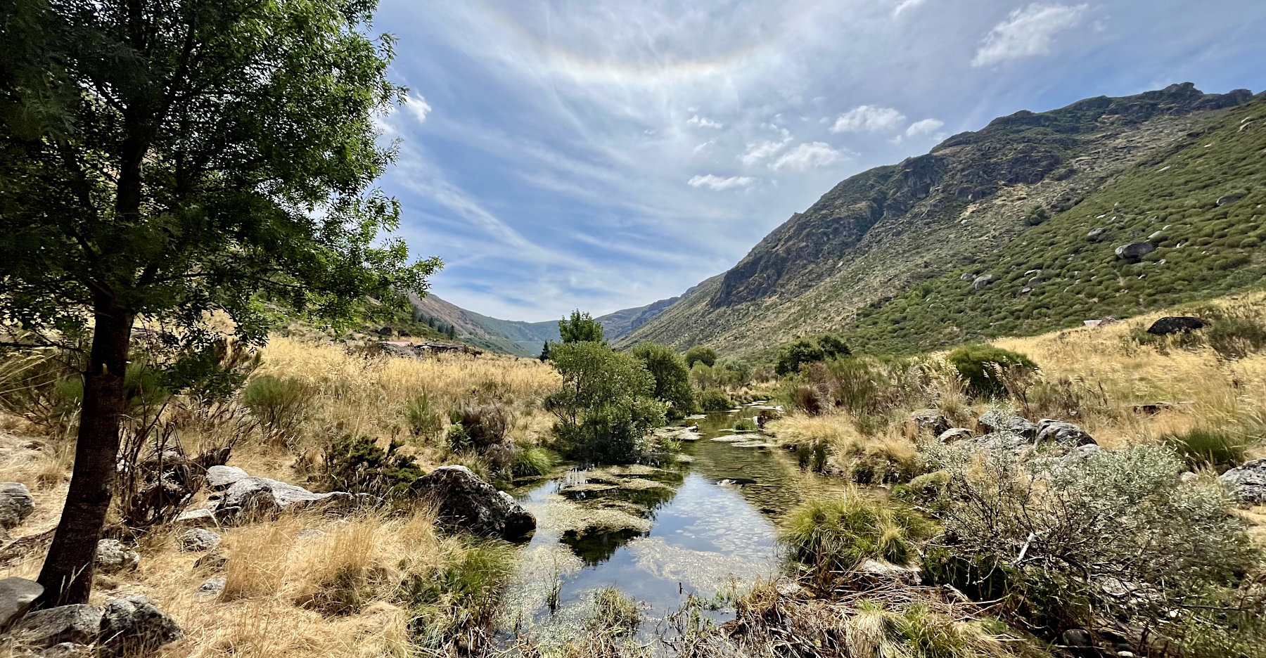
On descending from Manteigas, the PR6 MGT climbs gently up the Glaciated Zêzere Valley in a southward direction on various roads for a little over 2 Km before turning off and continuing on a lesser used gravel track. The going is pretty easy, however in hot weather you may still wish to pause at the Font das Lameiras Carlitos for drink of water. 3.5 Km from the road, a pleasant pool in the Rio Zêzere is passed where locals swim and cool down in the summer. A short distance later the river is crossed and the track curves northward to join the N338. Rather than follow it further, take the dirt track southward along the river's western bank (signposted). Keep an eye out for flocks of goat and their shepherds. This is a classic U-shaped valley, interpretation boards along the way suggest it is the biggest such example in Europe.

|
| The glaciated Zêzere Valley from the PR6 MGT as it crosses the Rio Zêzere. |
2 km after crossing the river, there is another bridge on your right where the PR5.1 MGT joins. It is also where the track narrows to become a path. 1.5 Km on and the PR6 MGT climbs steeply to meet the N338 road which it follows the road gently upwards to Covão d'Ametade where one could potentially camp the night. Here is also the source of the Rio Zêzere and the end (or beginning) of the GR33. As of August 2024 there was running drinking water here piped through a concrete slab in the meadow north of the river.
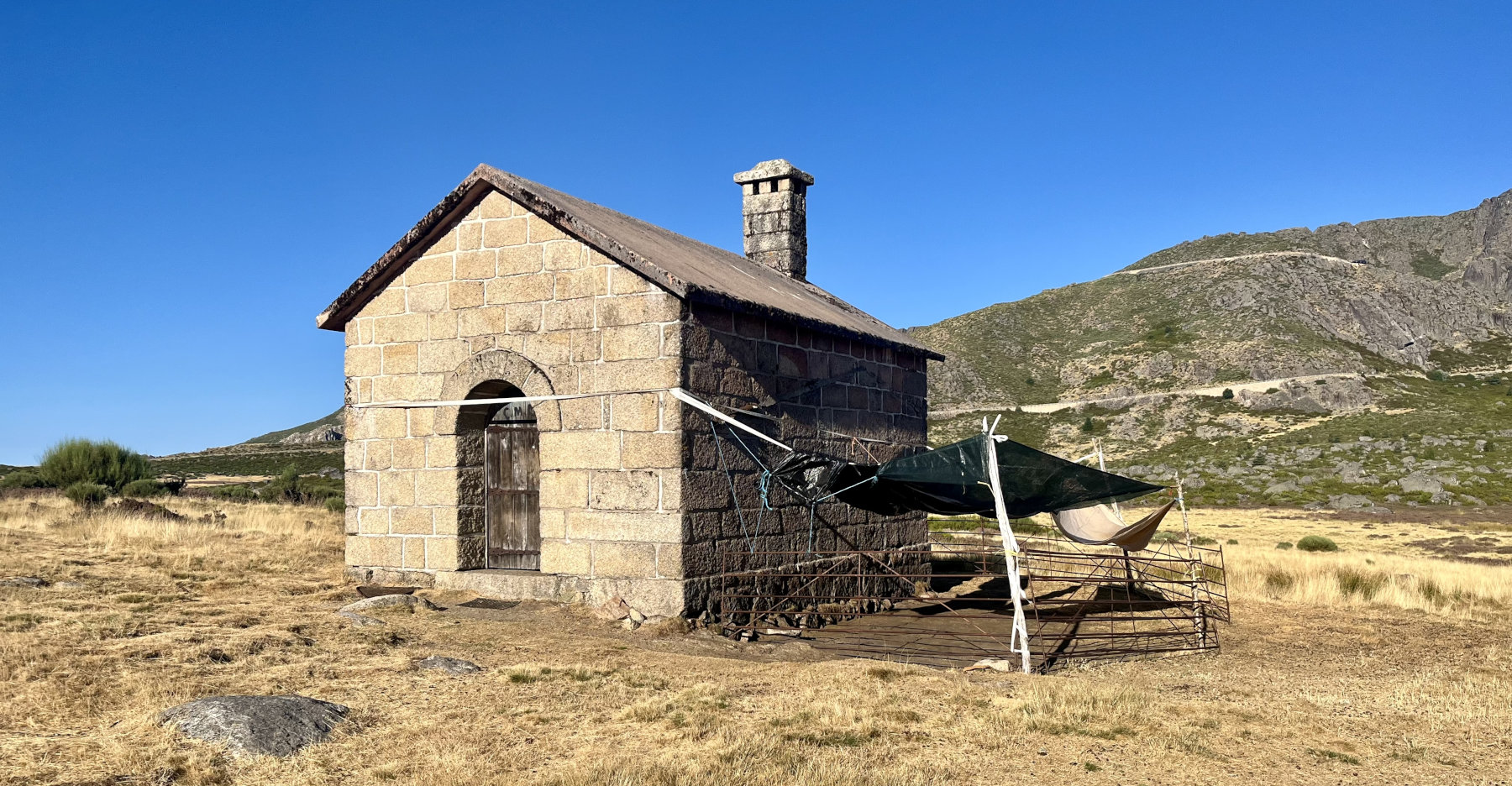
From Covão d'Ametade one follows the N338 once more, continuing up for 1.25 KM before taking the signed path into the cool woodland. Follow this through and out into the high pastures of Nave de Santo António where you may encounter another flock of goats. Shortly after passing a well built stone shelter you'll find the Font de Santo António, another water source (and possible wild campsite if appropriate consideration and discretion is taken, note, you are within a few metres of the road here).
|
| The pastures and shelter at Nave de Santo António. |
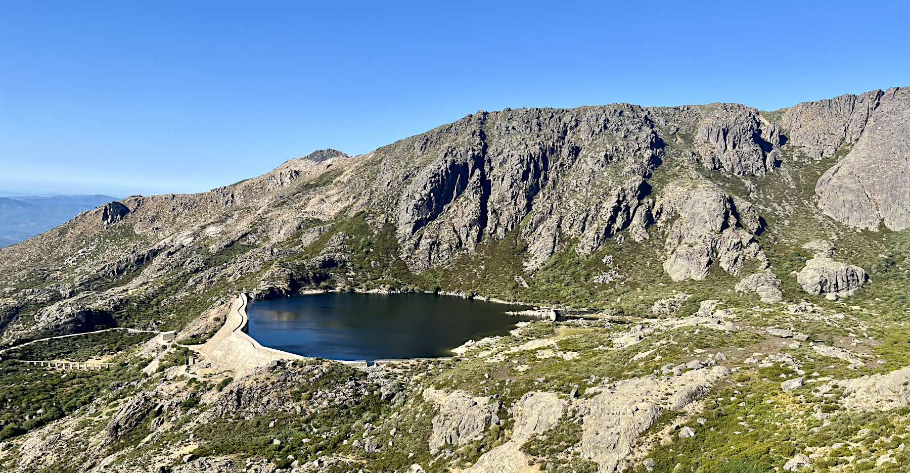
On leaving Nave de Santo António the PR6 MGT crosses the N338 summit road once again, ascending to a spur in the terrain called Espinhaço de Cão (The Dog's Spine), before dropping beneath it but continuing gently upwards above the waters of the Covão do Ferro reservoir. Having short cut a great distance of the looping road (had you followed it), the PR6 MGT once again emerges onto the N338 at Covão do Boi.
|
| The Covao do Ferro Reservoir from the PR6 MGT as it traverses below Espinhaço de Cão. |
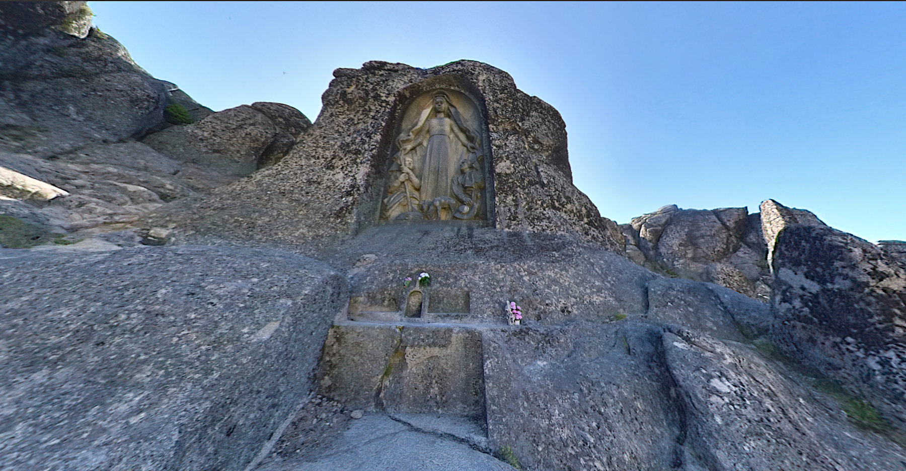
A little way ahead and on one's right hand side is the Nossa Senhora da Boa Estrela (Our Lady of the Good Star), patron saint of shepherds. This 7 m sculpture, carved into the granite and inaugurated in 1946, was the idea of Father António Duarte. A mass is held here every second Sunday of August which attracts many visitors.
|
| Looking up at Nossa Senhora da Boa Estrela, 7 m sculpture of Our Lady of the Good Star at Covão do Boi. |
Take the signposted PR6 MGT on the left hand side of the road 0.2 km after leaving Our Lady. The trail from here to the summit is indistinct, there being many paths worn into the turf that then disappear in the rocky areas. In good weather the route finding shouldn't be too difficult and you may come across the occasional faded red blaze. Should all go well, you'll be at the summit after 1.2 Km.
The route is 17.25 Km, with around 1300 m ascent. There is a PDF trail guide including map and photos to download, but the text is in Portuguese only. Information can also be found at natural.pt PR6 MGT Rota do Glaciar.

Please wait for Google Map to load here.
The PR4 MTG Rota do Carvão is a circular walk that climbs steeply from Manteigas onto the plateau where it can be followed southwards to the Ribeiro da Porta, or branch off a few minutes early to visit the shelter at Nave da Mestra.
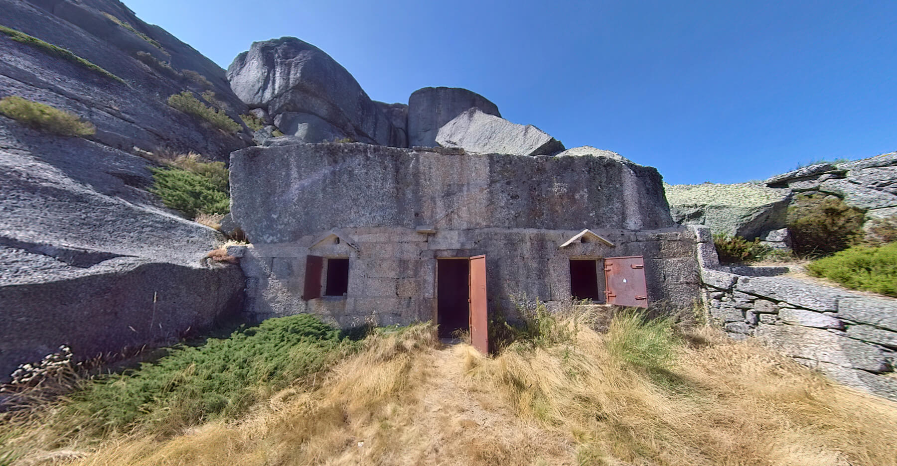
Start by following the yellow and red blazes of the PR4 MTG upwards out of Manteigas in a north then north westerly direction, zig-zagging on quiet roads and tracks before finally gaining the N332 at a serpentine bend after 4 Km and 450 m ascent. N.B. For much of the way the route is shared with the GR22.1. Take the first track on your left after the serpentine, just after the brown Manteigas welcome sign. The track is signposted allowing you to proceed with confidence. Follow the track as it continues to zig-zag up hill, ignoring any smaller trails to the left and right you should arrive beneath the Observatório Meteorológico das Penhas Douradas (Golden Rocks Meteorological Observatory). ¼ Km after the Observatory entrance, take the indistinct path to the left, passing through a fir plantation to emerge on the N232-1 at Casa da Fraga, a series of dwellings built into the rocks.

|
| Casa do Juíz (Judge's House) at Nave da Mestra |
On reaching Nave da Mestra the PR4 MTG descends in a north eastward direction back to the Zêzere valley, instead of doing so, join the PR5.3 MTG, a derivation Rota do Maciço Central. In August 2024, descending on this section of the PR5.3 MTG, I found the route finding tough, the trail appearing and disappearing for 1.4 Km until reaching the section in which it joins a path descending from the peak or Piornal and heads due west.
Having descended the slopes of Piornal, a clear path now climbs to Pico Cume, at 1858 m, a survey point crowned by a white washed, two tier cylindrical cairn. Continue southward on the obvious path for 0.6 Km to signposted junction (not all the direction pointers may now remain on the post). You have reached the western extreme of the PR5 MTG Rota do Maciço Central. The path on your left is descends to Lagoa do Peixão (Passion Lagoon) past which one can continue on to Covão d'Ametade or take one of the two derivations PR5.1 MTG or PR 5.3 MTG down to PR6 MTG in the Zêzere Valley.
Instead take the south easterly PR5 MTG towards Torre. After 1.7 Km and 33 m descend and re-ascent, another junction is reached. Whilst the PR5 MTG now descends towards Covão d'Ametade, take the PR5.4 MTG is a south westerly direction. Having walked a further 1.2 Km the N338 road is reached. Continue upwards along the road to the roundabout and follow straight across, taking the road the remaining distance to the summit.

For the first 16.6 Km this route follows that above, however instead of making the final ascent on the PR5 MTG & PR5.4 this route descends from the signposted PR5 MGT junction on unmarked and spurious paths to the N338 road. From here the broad track of the PR5 SEI is picked up (the SEI indicates that this PR is cared for by the Município de Seia rather than that of Manteigas). The PR5 SEI descends the Loriga Glacier Valley past the Covão do Meio reservoir to the village of Loriga. However after 1 Km and 90 m descent after leaving the N388 road, take the pathway heading southward from the track. It may be hard to spot, and in descent I missed it and joined the track further up. The path that you are looking for is a derivation of the PR5 SEI and is occasional marked by faided red blazes. For ¾ Km ascent 60 m to the dam of the Lagoa do Covão do Quelhas. The path passes the western shore of the reservoir, and in good weather it is worth taking a rest on one of the many large granite boulders to enjoy the view over the waters.
0.7 Km from the southern tip of the lake, the path turns from a southerly to an easterly direction, fording a stream and climbing gently towards the summit of Torre whose buildings, given clear weather, you'll see. The path here is unclear and unmarked, so avoid this route in poor visibility. For those confident reading the map and taking in the shape of the land, this route is excellent in both ascent and descent.
◦ Covilhã – Penhas da Saúde – Torre / T 14 PN -17Km, 1395m ascent This Old T Route still appears to be present in some form. I climbs steeply westwards out of Covilhã, soon joining the serpentine EN339 road to Penhas da Saúde after which it heads out on paths on the southern side of Lago do Viriato, rejoinging the EN338 for a few meters before taking a track to the left and then a path around the Albufeira de Covão do Ferro lake before climbing to joing the 6 MTG to the summit of Torre.
◦ Manteigas to Torre - Via T11 and T1 trails - (17.5 Km, ~1250m ascent)
The T11 trail winds it's way up hill from Manteigas for approximately 4 km before a spliting into the T11 and T12. Continue on the T11 southwards across high alpine landscape with views eastward over the Vale do Zezere for 9.5 km before joining the T1 trail near the trigulation post on Cume (1858m). Follow the T1 trail in a south-easterly direction toward the summit of Torre (1993m), crossing the 339 road on route.
◦ Manteigas to Torre - Via T11, T12 and T1 trails - (19.5 Km, ~1250m ascent)
The T11 trail winds it's way up hill from Manteigas for approximately 4 km before a spliting into the T11 and T12. Take the T12 trail for 3km and you will be standing at the junction with the T1 near the north-western end of the Rossim reservior. Follow the T1 trail southward for 12.5 Km to the summit Torre. The longer T1 section is not shown on Open Street Maps.
Getting there and away :
The city of Guarda is normally considered the gateway to the Serra da Estrela, and lies on the Portuguese rail network. However it is probably too far north for all but a traverse of the entire range. Those with less time will want to start nearer to the higher summits, usually at Manteigas or Covilhã, the latter also lying on the rail network.
For those flying into a convenient airport and renting a car, I would highly recommend staying in the old town of Manteigas, population 3430 (in 2011). It has a handful of pleasant restaurants, cafes, and bars.
Accommodation :
Camping : All land above 1200m has been designated a protected area in which wild camping is strictly prohibited. There is however the once official, but at of August 2024, abandonded and decaying campsites at Covão da Ametade, tucked away at the southern end of the Vale do Zezere with path and road access. Running water is still supplied, the toilet block much neglected but open if you dare.
Maps & Books
| OpenStreetMaps show the ascent routes. |
 Cicerone Press published "Walking In Portugal" by Simon Whitmarsh and Andrew Mok. The guide book Rota do Glaciar covers several routes in the Serra da Estrela, including the a trail from Torre to Manteigas.

 The Parque Natural da Serra da Estrela produce a 1:50,000 map identical to the civilian topographic survey, updated in 1998. Contours interval is 25 metres. Tourist information, prepared by the park authority, shows hiking paths, campsites, pousadas, youth hostels, shelters and refuges, places of interest, information centres, etc. Margin ticks indicate latitude and longitude in steps of 5'. Map legend includes English.
Useful Links
Click on www.visitportugal.com a to visit the website of the Portuguese Tourest office.
You can read the latest UK government travel advise to Portugal at www.gov.uk/foreign-travel-advice/portugal.
For a weather forecast, check www.mountain-forecast.com.