ESC - Ireland -
Corrán Tuathail / Carrauntoohil
, 1039 - Info | Trip ReportIntroduction :
Corrán Tuathail, anglicized to Carrauntoohil, is the highest mountain both in the Republic of Ireland and on the island of Ireland. Located in the MacGillycuddy's Reeks range in County Kerry's Iveragh Peninsula, it easy to spend time here exploring the countryside and enjoying warm Irish hospitality.
The name is derived from "Tuathal's sickle", a sickle being a short-handled farming tool with a semicircular blade, used for cutting corn, lopping, or trimming. If this counjours up images of narrow ridges, crags, and rocky terrain, you'll not be disappointed.
Glaciation has carved steep sided valleys into the red sandstone rock, leaving lakes, cliffs, and gullies, and many fine arêtes.
Most of the MacGillycuddy's Reeks, including Carrauntoohil, is on private land, and surprisingly not part of a National Park. Responsile and reasonable access is however granted to the hillwalker and mountaineer.
Routes :
The Tourist Route is said to be the easiest path to the roof of Ireland. It starts where the road ends at the mouth of Hags Glen (GR 837873), car park 2 euros. The path follows the Gaddagh River in a south westerly direction, passes between Lough Gouragh and Lough Callee before tackling the step scree slopes of the Devil's Ladder. Upon reaching col in the ridge line of the Reeks, the path follows the ridge north westerly to the summit. Decent is usually by the same path.

Traversing the Coomloughra Horseshoe. Caher in the background, Carrauntoohil off to the left, and Beenkeragh being climbed, Ireland.
A Traverse of the Macgillicuddy's Reeks offers the ultimate day on these mountains but is only for the fit. The route takes in eight Munros (peaks over 3000 ft), starting from the car park at Kate Kearney's Cottage north of the Gap of Dunloe (GR 881890), and follows the ridge line westwards to Lough Acoose. For more details on this route take a look at "The Big Walks" complied by Ken Wilson and Richard Gilbert.

|
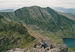
| The eastern half of the Macgillicuddy's Reeks as seen from Carrountoohil. |
Getting there and away :
Killarney, situated at the eastern end of the Reeks, is the nearest town of significant size and offers everything the hill walker requires; supermarkets, pubs, restaurants, hotels, guest houses, railway station, etc.
We took the car on the Fishguard to Rosslare ferry, sailing with Stena Line. Visit www.stenaline.co.uk to find out seasonal sailing times. This left us with a four and a half hour drive to Killarney which we broke with an overnight stop in a B&B just west of Cork.
Alternatively check out www.ryanair.com for cheap flights to Cork and Kerry.
Accommodation :
There is plentiful accommodation in Killarney and in private bed and breakfast all around the Reeks. Start by visiting the Irish Tourist Board Website.
Youth Hostels offer a good option for those travelling on a tight budget. Visit the Irish Youth Hostal Association website.
There are no mountain huts in the Reeks.
Maps and Books :
| OpenStreetMaps shows the ascent routes. |
 The best map I could locate was Number 78 of the Discovery Series published by the Ordnance Survey of Ireland, 1:50,000.
"The Big Walks" compiled by Ken Wilson and Richard Gilbert, and published by Diadem is a classic guide to the best Challenging Mountain Walks and Scrambles in the British Isles. Route 54 covers the Macgillicuddy Reeks and has excellent photos. ISBN 0-906371-60-0.
Useful Links :
You can read the latest UK governmen travel advise to Ireland, it might be useful.
For a weather forecast, check www.mountain-forecast.com.
