Cryprus - Mount Olmpus
, 1951m - Info | Trip ReportD. Stillingfleet, September 2003
It was mid October, the temperature pleasant, and the morning sky, blue and cloudless. I had parked at Pera-Pedi, a tiny hill village at around 770 metres above sea level on the southern slopes of the Troodos Mountains. Armed with a map supplied by the Cyprus Tourism Organisation and a guide book, I was setting off on foot for the Summit of Mt. Olympus, or Chionistra, "snow cap" as it is known by the Cypriots.

|
| View of Mt. Olympus on the road north from Lemesos |
At 1951 metres, Mt. Olympus is the Island's highest peak, and was number twelve on my round of each European nation's highest points. By starting at Pera-Pedi, I was packing the maximum into one autumn day; hiking an eleven kilometre route that linked tracks and nature trails in a bid to avoid the roads which snaked their way to the radar station that crowned the rounded hill top.
The track that headed north from Pera-Pedi narrowed quickly, I had expected an old mule trail and this fitted my romantic notions perfectly. A few metres past an old ruined hut, the trail became a thin path of flatten brush grass, thorn bushes snagged my trousers with hooked barbs and I was forced to consult the guide book. My mule track was in fact meant to be an asphalt road, I should have paid more attention. Releasing myself from the shrubbery, I retraced my steps to a U bend in the track and continued up what I had previously thought to be a private driveway. The track now wound it's way over a lightly wooded hillside where pine, olive and other thin leaf trees grew. They offered little shade but I was enjoying the warm sunshine on my back and the reassuring watery roar of the Kryos Poytamos "the cold river" hidden from sight in a steep sided ravine to my left. Reassuring because it confirmed I was on the right path. This river, the tourist literature tells me, never runs dry.
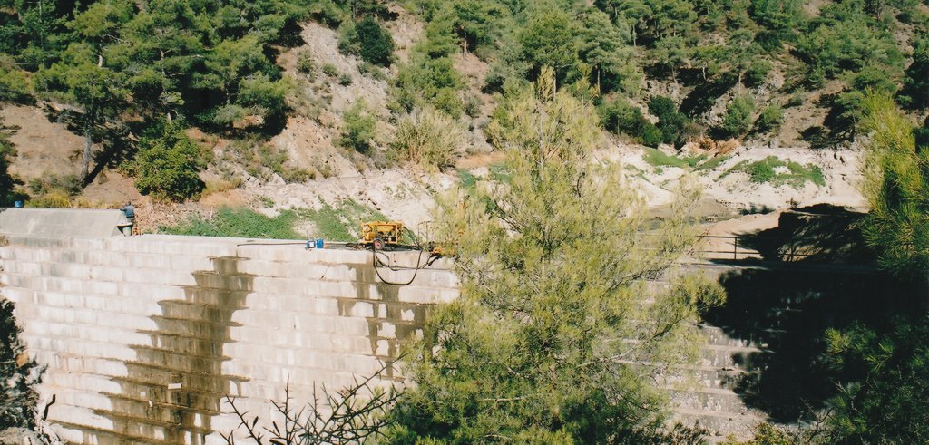
The Pera-Pedi reservoir lies about a kilometre and a half north of the village and the asphalt road is replaced here by a surface of broken stones. I was not expecting beautiful blue waters, and was therefore not disappointed. A dry summer had dwindled water supplies, and the sluice gate was now open so that what flowed in, flew out again. The remainder of the lake bed lay naked and exposed, an ugly muddy sheet that had hardened in the sun. I stopped momentarily to take a photo, drink from my bottle, and eat a cereal bar to supplement an early breakfast. The reservoir was my first landmark and I needed the break.
|
| The Pera-Pedi reservoir. |
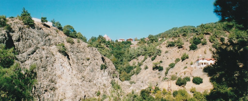
Shortly after leaving the reservoir, the village of Pano Platres came in to sight. Perched high above me, on a cliff facing the sun, the gleaming metallic dome of the Byzantine church identified the dwellings and took me away to a magical Arcadian land. It seemed unreal, and my camera was unable to capture the spirit of the scene. From my vantage point on the opposite side of the river the village looked impossible to reach, yet clearly I had to get there. How? On seeing a sign for the Myllomaris Waterfall, I once again consulted my guide book. It is never easy to follow a route description in the reverse direction, but the waterfall was on route so I headed off on what otherwise appeared to be a pleasant diversion. Even this late in the season, the 40 metre fall still had sufficient water to be appreciated, and I was joined by families and other groups at the bottom of a series of wooden steps to admire the cascade. Climbing back up these steps I noticed wooden fencing on the hill directly above. This echoed a description in the guide and was worth exploring, for somewhere up there was the path to Pano Platres.

|
| Myllomeris Waterfall. |
Construction was in progress at the Myllomaris tourist facility. Holes and concreted areas had been cordoned off, and another driveway had been ploughed into the hillside, it's purpose uncertain. I cautiously ascended the unsigned track to a point where it made sharp left turn, and there leading from the bend, half buried under a landslide of crumbling scree, lay a series of paved steps. This I reasoned was bound to be the right way, and amazingly, it was.
|
| Pano Platres perched on the cliff top. |
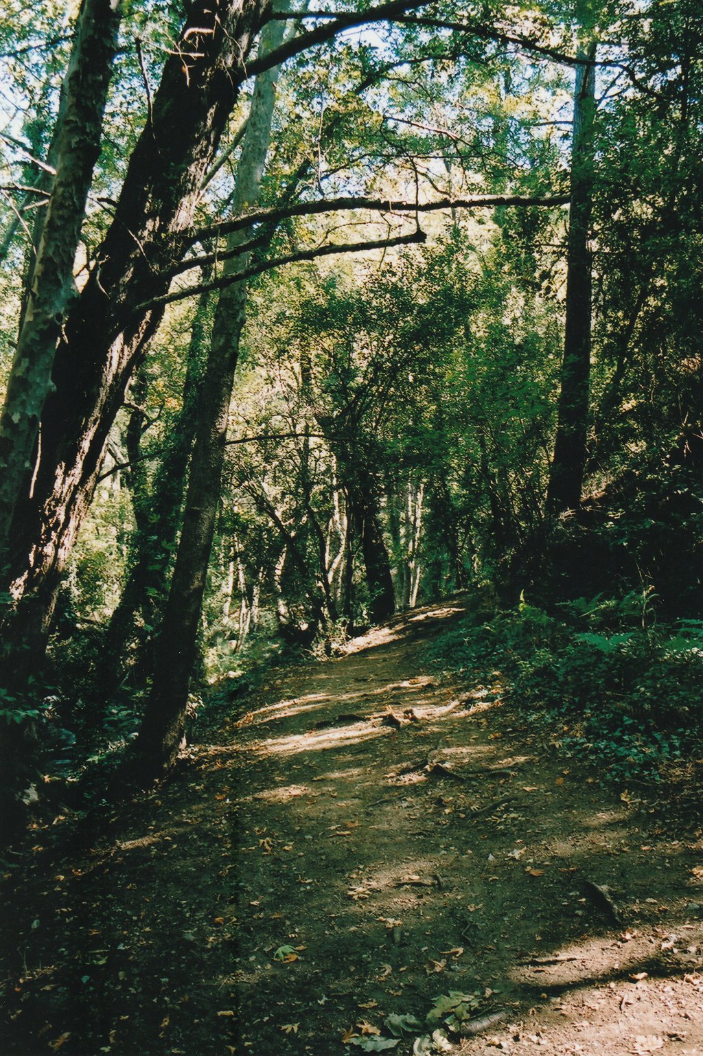
The landscaped changed. The transformation took place in the space of a few metres, in the rounding of a small hillock. It was a transition in colours, from dusty yellows and pale greys to the rich earthy brown of a broadleaf forest. I felt immediately at home here; the bubbling brook, the dappled sunlight and green leaves, all reminding me of northern latitudes. It was the brook I followed now, the path hugging its right hand bank before crossing over at a shallow fording point and then rising sharply up behind the lower houses of Pano Platres.
|
| Path along the Cold River. |
From below, Pano Platres had a mystical air, its lofty position giving it a hint of the orient. Once my feet touched the pavement outside the "Splendid Hotel", the illusion was shattered. This might once have been a quiet backwater, a reservoir of rustic life, but like the reservoir at Pera-Pedi, all that had once flowed in, had flowed out. The only flow now was that of the tourists being off-loaded from coaches to traipse between souvenir shops, and restaurants. The restaurants all appeared to have fish on the menu, specifically trout from the Psilo Dendro trout farm at the village's northern end.
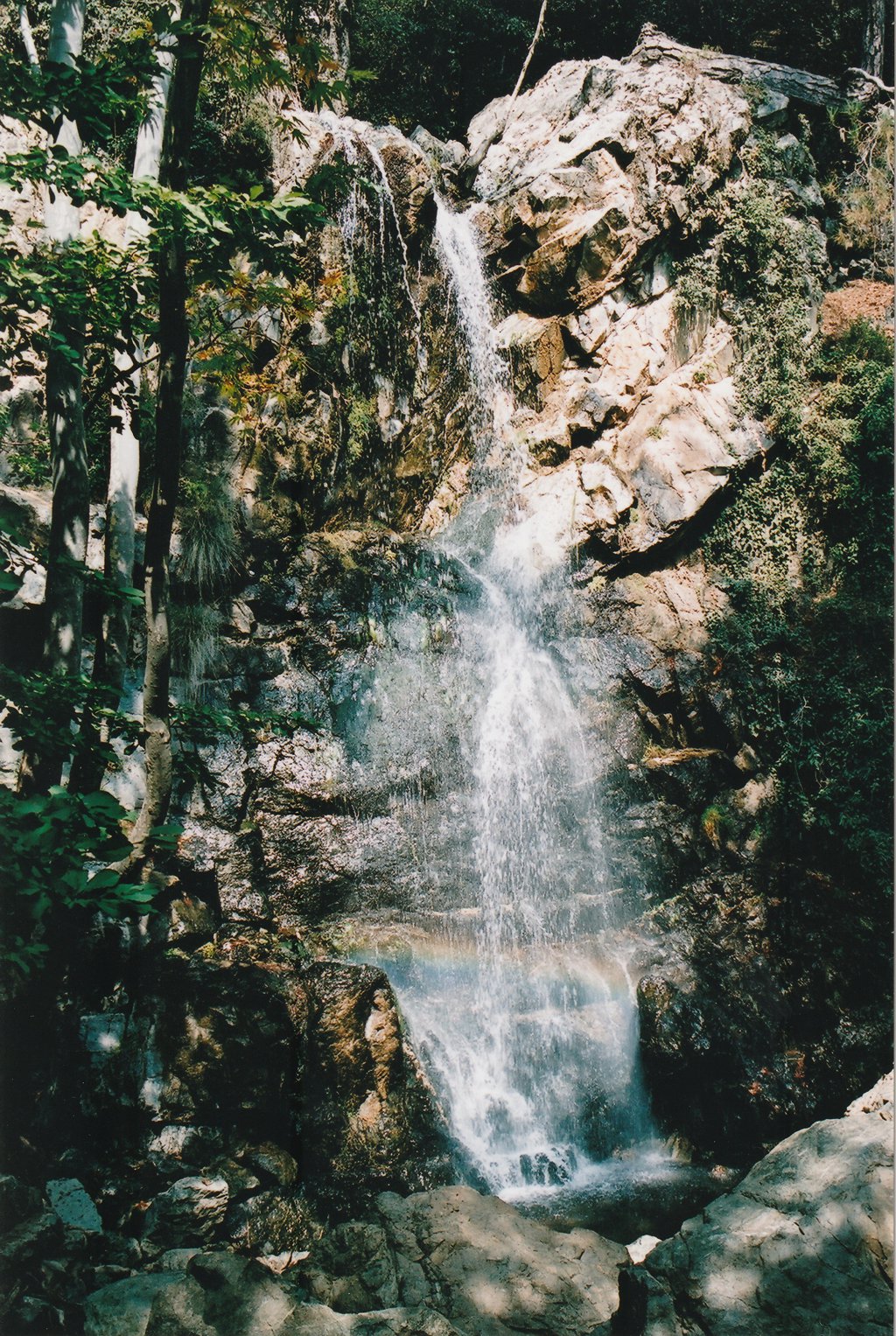
Next to the trout farm begins the Kalidonia nature trail. From around 1200 metres above sea level, the nature trail gave me a clean 400 metres of ascent before reaching the next road. Its boulder strewn path weaves its way along side, and often through the cascading Kryos Poytamos. Thick vegetation; oaks, rowan and alders hid any panorama, but there was plenty of action underfoot, a detail that delighted many a child. They hopped cheerfully from rock to rock, occasionally stopping to watch ill shod mothers teeter over icy waters. Disappointed that their parent never fell, they would run off to see what could be discovered beyond the next bend. My guide book had underestimated the routes popularity but I am certainly not complaining. About halfway along the Kalidonia nature trail stands the 15 metre Kalidonia Waterfall. I arrived in time to see a rainbow captured in the spray before gathering clouds hid the sun. A photograph was definitely in order and a friendly local walking with his wife obligingly took one for me whilst I seated myself in frame. From then on upwards the human traffic became light, though there was never the element of a wilderness. Mt Olympus could never be classified as a wilderness.
|
| Kalidonia Waterfall |
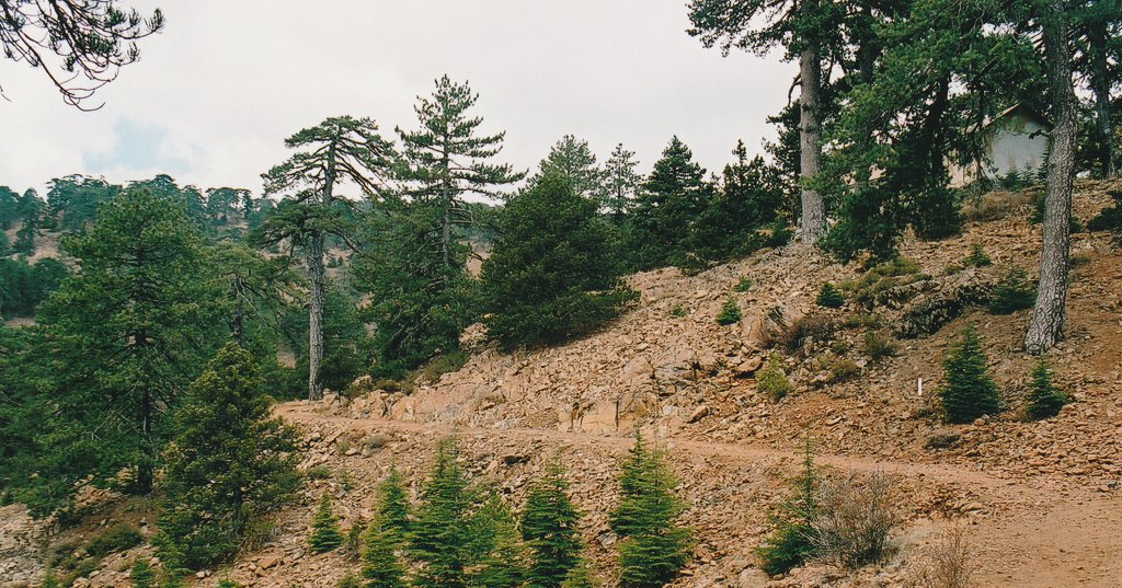
At the northern end of the Kalidonia nature trail, the path came to an abrupt halt and I was forced to take to the road once again. Trudging up the serpentine bends of the old road made me feel like an observer of other people motorised ascents and in some peculiar way I no long felt a participant in my own journey. In hindsight I would have liked to have explored, followed the course of the Kryos Poytamos, scrambled up unknown waterfalls, to have discovered from where the water started flowing. Instead I hardly noticed the second change in my environment until the old road met the new road just before Plateia Troodous. The brown soil and broad leaf trees had sunk behind me. Now the trees were pines and the bare soil and rocks between them had a red, almost Martian tinge. The sun was well hidden by cloud and for the first time on the island I was cold. I threw on a thin pertex smock to keep the wind at bay and hurried on through the tourist market of Plateia Troodous to the start of the Atalante nature trail which in one 12 kilometre loop circles Mt. Olympus at about 1700 metres. Its name is not to be confused with the myth of Atlantis, but is instead derived from a wood nymph of Greek mythology infamous for murdering her one night stands.
|
| Atalante Trail |
Within ten, fifteen minutes the Atalante trail crossed the dry bed of the Kryos Poytamos and I began the search for a track clearly marked on the map, that would take me directly up towards the summit road. The track could not be found, so I followed the river bed and then a compass bearing up the hill side. I joined yet another nature trail, the Artemis, briefly, before arriving at a sharp road bend. It was here that I got my first view of the giant white protective dome of the British military radar station. Knowing that photography beyond this point was going to be prohibited, I paused to take a photo as evidence of my arrival. I had expected to have had to endure more road walking, but dirt tracks had been bulldozered up to and along the broad ridge line, possibly to provide a ski run during the winter season.

|
| Mt. Olympus Radar Station |
It was here too that I encounter a mad dog. I've never cared much for dogs so I could not tell you it's breed, but was brown, scruffy, and liked chasing cars along the mountain road. If it could run in front of the car or leap up at the window so much the better. I knew the instant I saw the beast I was in for trouble and so armed my self with hefty stick with which to clout the animal if it turned on me. For a while the dog ignored me, the traffic proving a far more interesting distraction, but when the traffic cleared there was no escape.
I have two deeply held believes concerning dogs; The first is that they can pick up on those humans who are afraid of them, and second, that they then attack those humans they have identified. Working with this rationality I introduced myself to the canine and asked it how it was. Maybe this was a mistake, from then after the dog adopted me, passing me off as it's owner for the next hour or so. It followed me as I made my circuit of the radar station's parameter fence, sat patiently waiting for me as I tried to persuade private Monk to allow me to take a photo, as I hinted in vain that I would very much like to stand on the mountains summit. When I headed off along the road, it followed too, breaking away only to hound on-coming vehicles, and for me to receive the occupant's hostile stares. The animal did not stop when I left the tarmac, continuing the master / pet charade even when I headed back across country. Only when we entered Plateia Troodous did it give up and disappear into the crowd.
Once back at Plateia Troodous I had a choice of two routes; either return the down the road and the Kalidonia nature trail, or to follow a slightly longer route mentioned in the guidebook that would take me down to Pano Platres, bringing me out down the road from the Psilo Dendro trout farm. I looked at my watch, though running out of time, I chose the latter option. Again I was walking a route described by my book in the reverse direction, and this proved to be my undoing. Junctions and paths when arrived at from one direction are often easy to ignore, and in the guidebook they were just that. When trying to trace the route from above, the task was impossible. I passed the army camp on the narrow road south, passed the small church of St. George-in-the-Forest, all fine so far. Then there were roads a plenty, far more than shown on the map, all of equal width and all heading downhill, access roads to dozens of summer chalets hidden in the woods. I plumed for the centre line and stopped to ask a group of friends barbequing their last meal before returning home from a weekend's partying. They were welcoming and gave roasted goats cheese, homemade brandy, and advice in equal measure. The food and drink proved better than their advise for they hadn't a clue as to a possible route down to Pano Platres other than by the road. On sharing the map they agreed that a path there should be and wished me good luck. I continued on down.
When the tarmac came to halt outside the lowest chalet, I almost admitted defeat and began to backtrack. Whilst doing so, and coming at it from the opposite direction, I notice a path heading roughly the right way. The path's entrance had been blocked by a low ridge of soil, leaves, and branches, an attempt of discouragement if ever I saw one. The path itself was leaf covered and it appeared that no one had disturbed them for a long time. There was no returning to the Plateia Troodous now, I chanced my luck. At a junction in the overgrown path, a neglected sign indicated that I was back on course, and a little further on I came to a dirt track contouring the hillside. The track could easily be identified on the map, and at significant sharp bend I was able to locate myself with reasonable precision, unfortunately the same could not be said for the path that I was supposed to head on down. The map supplied by the tourist office suggested I should follow the track westward before descending, the map in the guidebook the opposite. Suspecting that the guidebook was a little more accurate, I tested this out but found nothing but another overgrown mule trail heading off to the Makrya Kontarka viewpoint. I tested the map by hiking westward but found nothing that way either until reaching the northern Kalidonia nature trail head. I made my peace with the inaccuracies of the maps and contented myself to descend on familiar ground.
