Mountains of the British Isles > Wales >

Carneddau | VR Tour


The Carneddau (The Cairns) are the northern most range of mountains in the Snowdonia National Park, and form a the largest contiguous area in Wales and England above 3000 ft (910 m). As well as fine ridge walks, some of the countries highest peaks, and interesting scrambles, the mountain group incompasses lakes, streams, waterfalls, and historic sites. The Bronze Age left standing stones, and indeed the multitide of burial cairns after which the mountains are named.

Now its your time to explore.

Float cursor over picture button below the map to view start location from above.
Resume Previous Tour

Please wait for Google Map to load here.
Carneddau
Start from Pont Pen-y-benglog
Start from Tal-y-llyn Ogwen
Start from Pen Yr Ole Wen
Start from Carnedd Dafydd
Start from Carnedd Llewelyn
Start from Foel Grach
Start from Carnedd Gwenllian
Start from Foel-fras
Start from Drum
Start from Tal y Fan
Start from the Sychnant Pass
Start from Mynydd_y_Dref
Start from Conwy Castle

List of Peaks:


PeakSort

HeightSort

NuttallSort

Bera Bach  807 mWN 1.10
Bera Mawr  794 mWN 1. 8
Carnedd Dafydd1044 mWN 1.16
Carnedd Gwenllian
(Known as Carnedd Uchaf until 2009)
  926 mWN 1.11
Carnedd Llewelyn1064 mWN 1.15
Carnedd y Ddelw  688 mWN 1. 2 Demoted
Craig Eigiau  735 mWN 1.13
Craiglwyn  623 mWN 1.23
Creigiau Gleison  678 mWN 1.21
Creigiau Gleison North Top  634 mWN 1.20
Drosgl  758 mWN 1. 7
Drum  770 mWN 1. 4
Foel Grach  967 mWN 1.12
Foel Meirch  800 mWN 1.22
Foel-fras  942 mWN 1. 9
Gyrn Wigau  643 mWN 1. 6
Llwytmor  649 mWN 1. 3
Pen Llithrig-y-wrach  799 mWN 1.18
Pen y Castell  623 mWN 1. 5
Pen yr Helgi Du  833 mWN 1.17
Pen yr Ole Wen  978 mWN 1.19
Tal y Fan  610 mWN 1. 1
Yr Elen  962 mWN 1.14

The Carneddau:


Whilst I have ventured onto the Carneddau many times previously, the panoramas taken to build the Carneddau tour thus far have been taken on a single trip in May 2024. Expand article

The higher and more frequented peaks of the Carneddau are in its south. Infrequent routes ascend from near Llyn Ogwen and along the A5, the road that marks the range's southern boundary. Very fine ridge and wilderness walking can be had here, far from the crowds found on Snowdon. However, on the occasion of photographing my first virtual tour of the range, I was following the Cambrian Way trail from Conwy in the northeast, and thus entered the Carneddau a little differently from most visitors. This was to be the first day of three in the mountains. Having traversed the Carneddau northeast to southwest I wild camped that first night by the shores of Ffynnon Lloer. Rising early the following day I traced the Cambrian Way along the northern shore of LLyn Ogwen to the YHA at Idwal Cottage, traverse the Glyderau, descend to Pen-y-pass, and cross over Snowdon to camp at the National Trust's Hafod-y-llan campsite. Day three, a half day and less demanding, took me southeast of Llyn Dinas, to Beddgelert. Leaving Beddgelert the Cambrian Way took took first to the west bank and then to the east bank of the Afon Glaslyn to the Pont Aberglaslyn and Nantmor. This latter stretch is a great walk after which the CW leads by single track road into the foothills of the Moelwyns.

The 360° photos on this tour were taken with an Insta360 One X, edited in GIMP, and enhanced with Topaz AI tools. Expand article

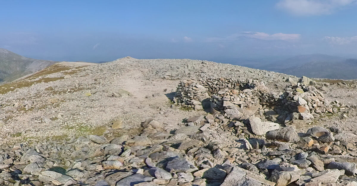
Wind breaks built from rock pillaged from the bronze age cairn on Carnedd Dafydd.